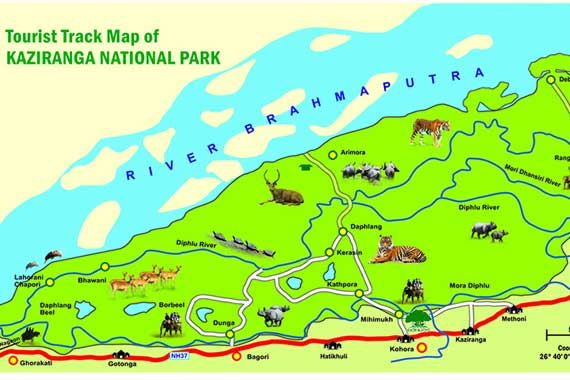
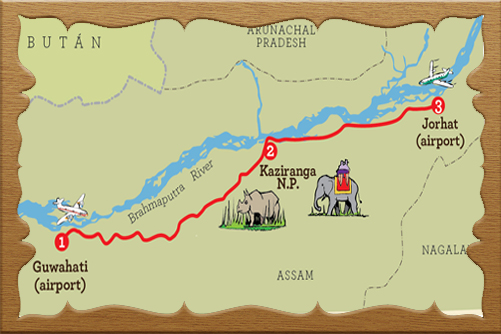
The Kaziranga National Park is situated in the floodplains of the Brahmaputra River in the districts of Golaghat, Nagaon, and Sonitpur in Assam, India at 26°35′-26°45’N and 93°05′-93°40’E covering an area of 1030 sq. km. On the southern bank of the Brahmaputra River, it is the largest protected area.
The Topography of the national park is flat with an east-west inclination. Due to its location in the Brahmaputra river floodplain, the soil of the national park is rich in fertile alluvial deposits. A Plethora of small channels and rivers flow through the national park drenching the area from east to west. The Diphlu river passes through the Kaziranga National Park, and there are over 250 seasonal water bodies in the park. Most of which originate in the Karbi Anglong Hills to the south, run in the north, and ultimately drain into the Brahmaputra River, widening its catchment area.
Also, the Kaziranga National Park is traversed by National Highway 37.

02 Night - 03 Days

06 Night - 07 Days

04 Night - 05 Days

02 Night - 03 Days

01 Night - 02 Days

08 Night - 09 Days